 |
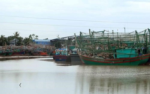
| Illustrative photo (Source: VNA) |
As of 7 am of August 1, the storm was at 19.9 degrees north latitude and 110.7
degrees east longitude, about 360km east-southeast of the northern coastal
provinces of Quang Ninh and Hai Phong’s inland areas, with winds near its centre
having a velocity of 75-90 km per hour. Moving at the speed of 15km per hour,
the storm will reach the northern waters of the Gulf of Tonkin in the evening
and is expected to gain more power.
It is projected to hit waters offshore and inland areas of northern localities
from Quang Ninh to Nam Dinh on August 2 and 3. The storm will then change its
course from west to west-southwest and weaken into a low tropical pressure.
As a result, since the afternoon of August 1, rain, strong wind and whirlwind
are expected in the northeastern region. From the evening of August 1 - 4,
northern and north-central provinces, particularly Quang Ninh, Hai Phong and
Lang Son, will experience heavy rain.
Flood will hit river and stream areas in the northern region as well as the
central provinces of Thanh Hoa and Nghe An.
Flash flood, landslide and flooding are forecast for mountainous provinces in
the northern and north-central coast regions, particularly Quang Ninh, Lang Son,
Bac Kan, Cao Bang, Ha Giang, Yen Bai, Lao Cai, Hoa Binh, Son La, Lai Chau, Thanh
Hoa, and Nghe An.
Authorities in Quang Ninh, Hai Phong and Nam Dinh have prepared a range of
safety measures to deal with the incoming storm. Fishing and tourism boats have
been urged to keep track on the storm, come back to the shore or seek shelter.
Particularly, the Quang Ninh People’s Committee has ordered relevant agencies to
temporary stop allowing all vessels to set sail while all operating ships must
arrive in safe shelters before 12 p.m of August 1.
Evacuation plans for residents in vulnerable areas, the protection of
agricultural production, and the readiness of search and rescue forces are also
prioritised.-VNA


.jpg)


.jpeg)

.jpeg)


.jpeg)


